Boating on the St. Croix River offers opportunities for creating great memories and enjoying the unforgettable beauty of our National Scenic Riverway. At times like these, getting out onto the water feels like a welcome escape from being inside our homes, and it is possible to enjoy this activity safely in compliance with social distancing protocols and other regulations.
It’s important to know how fast you can go in certain sections of the St. Croix, and to pay close attention to these regulations. Here is a guide to what you should know before venturing out.
First, what is the difference between slow speed and slow/no-wake?
Slow speed is the operation of a motorboat at a leisurely speed—less than planing speed, and where the wake or wash created by the motorboat is minimal.
Slow/no wake is the operation of a motorboat at the slowest possible speed necessary to maintain steerage without creating a wake.
So, slow speed means minimal wake while not on plane, and slow/no wake means minimum speed for steerage without creating a wake.
What difference does this make for my river experience?
While it might seem that someone can go any speed they like on any part of the river, that is not the case. Regulations vary for different areas of the river.
For example, the Lower St. Croix from Taylors Falls/St Croix Falls to the Arcola sandbars at Mile 31.0 (approximately the Apple River) is always a slow speed zone, except when slow/no wake is in effect. In other words, there is never a time when a boater in this section of the river should be going fast enough to create a large and unreasonable wake.
When and where is slow/no wake in effect?
- Throughout the entire lower river, from the Xcel Dam in St Croix Falls/Taylors Falls to the confluence of the Mississippi River at Prescott, whenever the water level reaches or exceeds 683.0 feet mean sea level, as measured at the Stillwater gauge.
Slow No Wake Laws: (36CFR 3.2(a) MN 6105.0330.2, WI NR 5.33(1))
- In the Federally-managed zone (north of the Stillwater Boom Site), Operating a vessel in excess of flat wake speed within 100 feet of:
(i) A downed water skier;
(ii) A person swimming, wading, fishing from shore or floating with the aid of a flotation device;
(iii) A designated launch site; or
(iv) A manually propelled, anchored or drifting vessel. (36 CFR 3.8(b)(4))
- Within 100 feet of shore (including the shores of islands) and of swimmers, from sandbars located approximately at mile 31.0 (Apple River Confluence) to the confluence of the St. Croix River with the Mississippi River.
100 feet from shore laws: (36CFR 3.2(a), WI NR 5.33(1), MN 6105.0330.2)

(Photo: Craig Blacklock)
Why is it important to follow these regulations?
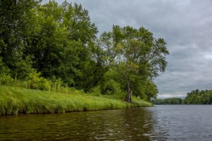
The St. Croix National Scenic Riverway is an important habitat for numerous species of animals and protects a wide range of ecosystems. One such ecosystem is the riparian zone, which is the place where the river meets the land. Excessive wakes can create movement that wears away at the land at the edge of the river to cause erosion. This can have serious consequences over time. In extreme circumstances, erosion at camping sites and landings have forced closures for expensive, extensive repairs.
In addition to the environmental impacts, creating a large wake means more noise from a boat, which disturbs a rare solitude in sections of the river that contributes to the St. Croix’s appeal for many. And if you have been swimming or floating in the river when a big wake came your way, you know it isn’t fun to get smashed in the face by a wave or tipped off your float because somebody didn’t slow down.
Following these regulations ensures that all can enjoy the river and what it has to offer—not just for our generation, but for those to come. It’s the easiest way to make a positive contribution to the preservation of the river’s values at the same time as enjoying them.
If you spot someone practicing unsafe boating practices, including a disregard for speed regulations, call 1-800-PARKTIP to report issues and problems.
This tip line connects with NPS Dispatch 24/7, allowing for timely response and tracking.
Thank you for being a safe boater, and for helping protect our river National Park!
